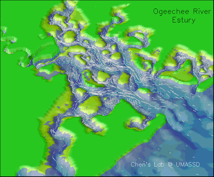
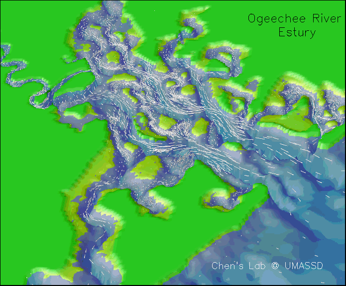
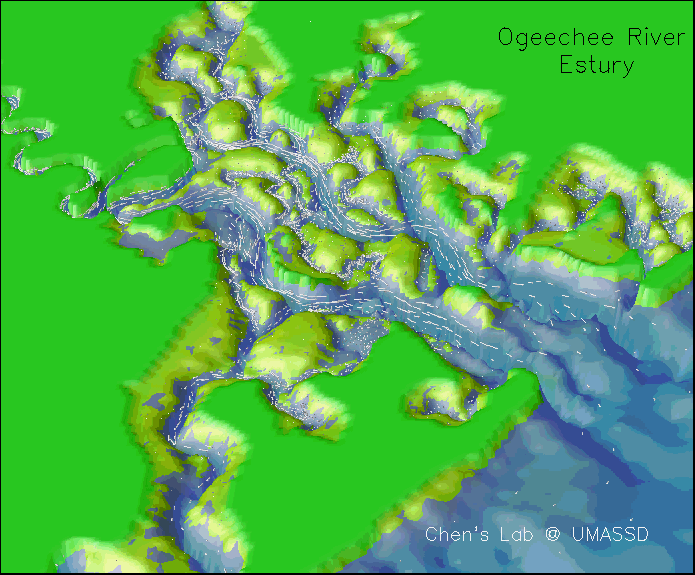
We simulated the water transport into and out from the inter-tidal salt marsh. The results clearly show that this new technique not only provides more detailed structure of the water movement and transport over the estuarine-tidal creek-salt marsh complex but also captures a right physics of the flooding/drying processes in the Ogeechee River Estuary. A successful example can be seen in figures attached on this page, which shows the cover area of water overlapped with surface current vectors in one tidal cycle. When the water is advected into the estuary during flood tidal period, the water flows into tidal creeks and also flood over barriers and the salt marsh area. Most parts of the marsh area were covered by the water at the high water level. The water flows back to the main channel during the ebb tidal phase, and then restricted to the main channel and tidal creek at the low water level. At the spring tidal cycle, the water could cover the entire area bounded by the 2-m elevation lines.
This is the first innovative modeling accomplishment in the Ogeechee River Estuary, which has provided us a scientifically-sound tool to valuate the water exchange process in this estuary. This model also makes it possible to build a monitoring model system for the salinity and water quality. |
