It is driven by the NCAR-ETA weather model through a nested numerical approach. A data nudging assimilation method is used to merge the predicted and the observed surface wind stresses. The assimilation data includes wind speed and direction measured by NOAA's coastal ocean buoys and weather stations. The original MM5 suffers from a deficiency when applied to the ocean because of an unrealistic simplification of the air-water temperature difference and an incorrect representation of marine boundary layer thermodynamics over the water's surface (Dudhia et al.,2003). MM5 tends to overestimate the sensible and latent heat fluxes at the water's surface. To make MM5 useful for our purposes, we have replaced the current heat flux equations with the bulk flux algorithms proposed by Fairall et al (1996). The modified MM5 presents an accurate estimation of the near-surface transfer process and air-water temperature difference under various stable or unstable thermal structure conditions in the near sea-level atmospheric boundary (Chen et al., 2003). The modified MM5 shows excellent agreement with long-term wind and heat flux data measured by the US GLOBEC buoy located on the southern flank of GB (Georges Bank) in 1995.
The wind stress, surface pressure, surface heat flux and precipitation/evaporation output from the MM5 are used to drive the Ogeechee River Estuary model. Since MM5 is capable of providing a 3-5 day forecast of local weather conditions, it was used to develop water and current condition forecast systems for the Ogeechee River Estuary.
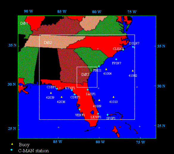
An animated example comparing model-predicted and observed wind velocities over the South Atlantic Bight may be viewed here. |