The ECOM-si is the 3-D finite-difference, primitive equation coastal ocean model developed based on the original code of the Princeton Ocean Model (POM) (Blumberg and Mellor, 1987). We incorporated a web/dry point treatment technique into ECOM-si and used it, as a first step, to simulate the tides, tide-induced current, salinity distribution due to mixing between freshwater and oceanic water in the estuary. This study was conducted with understanding of the ECOM-si would not be able to resolve tidal creeks and complex barriers islands' geometry. Therefore, it is good for the purpose of mechanism study but is inappropriate to be used for real-time simulation and coastal management. In particular, like other structured grid finite-difference models, ECOM-si fails to resolve tidal creeks, barriers, and islands, it causes a wrong water transport process in the Satilla River. Because of this reason, we have replaced the ECOM-si by our new finite-volume model (FVCOM) for the study of the Satilla River Estuary. Showing the ECOM-si's results here is to give the public a more complete view of different phase model developments.
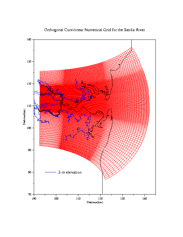
Ecom-si Satilla River curvilinear grids. Horizontal resolution is about 100 m inside the river and about 10 km near the open boundary. Due to the limitation of structured grid in geometric fitting, tidal creeks in this model is treated as the intertidal salt marsh zone. When creeks become wet, the realistic bathymetry is used for model grids.
|
|
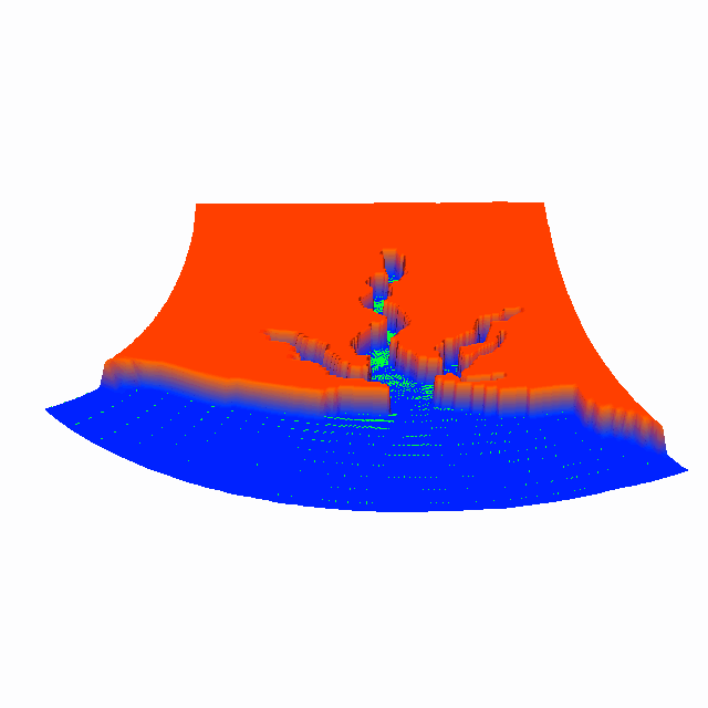
Animation of the flooding/drying process predicted by Ecom-si during tidal cycles. It can be seen clearly that the model can capture the flooding/draining process over estuarine-intertidal salt marshes, but not tidal creeks. We believe that the water transport is correct, but the detail of the current movement would not be realistic, particularly for the fluid particle trajectories. It might overestimate the water exchange rate and the residence times. Click here or image to view the animation.
|
|
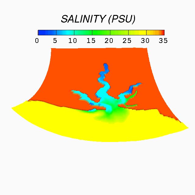
Animation of the near-surface salinity during tidal cycles. Because the water is well mixed in this estuary, the salinity is almost uniform in the vertical. The model did a pretty good job to simulate the salinity in the main channel of the river, but not in tidal creeks and marshes. The model can not resolve the spatial variaiton of the salinity well due to the limitation in geometric fitting. Click here or image to view the full-size animation.
|
|
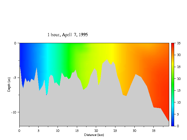
Animation of the along-river distribution of the salinity during tidal cycles. This is the simulation result for the April 1995 survey. The model did a pretty good job in the along-river direction in the main channel of the river. Click here or image to view the full-size animation. |
|
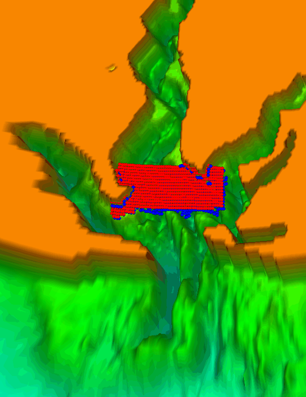
Trajectories of particles released at slack high water in the case with only tidal forcing. Red: particles released near the surface; blue: particles released at mid-depth. Because of the limitation of ECOM-si in resolving the coastal geometry, the trajectories of particles would be very different from the water exchange movement over the estuarine and salt marsh complex.
Click here or image to view the full-size animation.
|
|
Trajectories of particles released at slack low water in the case with only tidal forcing. Red: particles released near the surface, blue: particles released at mid-depth.
Click here or image to view the full-size animation (be patient because the gif file is big). |
|
Trajectories of particles relased at slack high water in the case with tidal plus wind forcing. Red: particles relelased near the surface; blue: particles released at mid-depth.
Click here or image to view the full-size animation (be patient because the gif file is big) |
|
Animation of the along-river distribution of the suspended sediment concentration during tidal cycles. The model-predicted distribution is in good agreement with the field measurement data.
Click here or image to view the full-size animation. |
|
Animation of the near-surface DO concentration during tidal cycles for the spring 19995 simulation experiment. The model captured the long-river trend.
Click here or image to view the full-size animation. |
|
Animation of the along-river distribtion of the DO concentration during tidal cycles for the spring 19995 simulation experiment. The model captured the long-river trend.
Click here or image to view the full-size animation. |
|
|